How Heat Domes Form Over India Before Monsoon: April Temperature Records Explained

India Heat Wave April 2026: When the Subcontinent Becomes an Oven
India recorded temperatures exceeding 115°F (46°C) across multiple states in April 2024, with Rajasthan hitting 120°F (49°C) — conditions that make outdoor activity genuinely dangerous for hours at a time. These extreme pre-monsoon heat waves follow predictable atmospheric patterns that transform the subcontinent into a continental furnace each spring. Understanding how heat domes form over India explains why April and early May consistently produce the year's most punishing weather.
The Meteorology Behind Pre-Monsoon Heat Buildup
Heat domes develop when high-pressure systems stall over northern and central India, trapping hot air close to the surface like a lid on a pot. The jet stream retreats northward in April, removing the atmospheric disturbances that would normally break up these pressure systems. Clear skies allow solar radiation to heat the land surface relentlessly, with daytime temperatures climbing 5-8°F (3-4°C) above seasonal averages.
The timing connects directly to monsoon mechanics. As the landmass heats up, it creates a massive low-pressure zone that will eventually draw moisture-laden winds from the Indian Ocean. But this transition takes weeks to develop, leaving much of the country baking under stationary high pressure through late April and into May.
Northwestern plains bear the worst of it. States like Rajasthan, Punjab, and Uttar Pradesh routinely see maximum temperatures above 110°F (43°C), with overnight lows stuck around 85°F (29°C). The lack of oceanic moderating influence makes these interior regions particularly vulnerable to sustained heat.
Which Regions Face the Most Dangerous Conditions
Rajasthan consistently records India's highest pre-monsoon temperatures, especially around Churu and Phalodi, where the mercury regularly approaches 120°F (49°C). The Thar Desert's sandy soils heat rapidly, and westerly winds blow in additional hot air from Pakistan rather than providing relief.
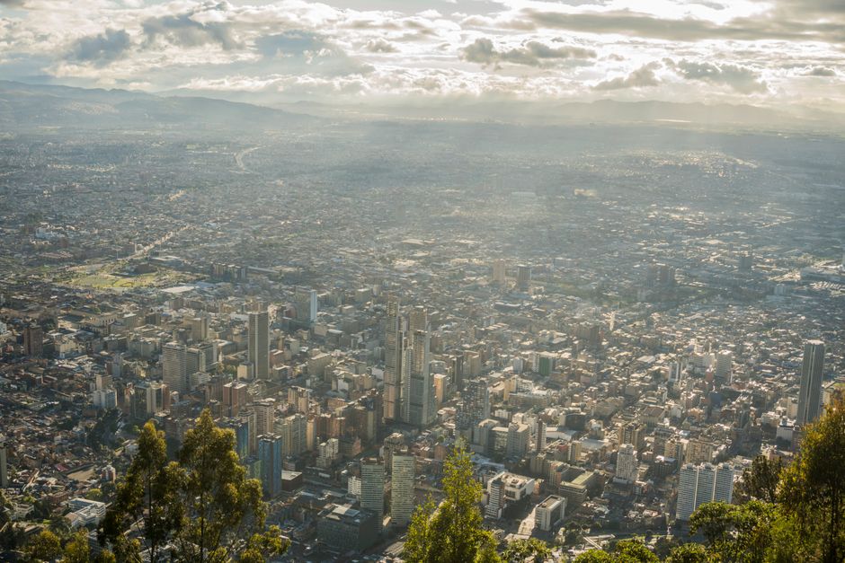
The Indo-Gangetic Plain stretching from Delhi through Bihar creates its own heat island effects. Urban areas like Delhi, Lucknow, and Patna see temperatures spike 3-5°F (2-3°C) above surrounding rural zones due to concrete absorption and reduced vegetation. Humidity stays relatively low — 20-30% — but the combination still creates heat index values exceeding 115°F (46°C).
Central Indian states including Madhya Pradesh and Maharashtra face a different challenge: heat combined with building humidity as monsoon moisture begins creeping inland. Nagpur and Akola regularly hit 113°F (45°C) with humidity climbing toward 40%, making outdoor conditions genuinely oppressive.
Coastal areas like Mumbai and Chennai stay comparatively cooler due to sea breezes, but humidity levels above 70% create their own misery. Maximum temperatures around 95°F (35°C) feel much worse when combined with moisture that prevents effective sweating.
Why the Heat Intensifies Right Before Monsoon Arrival
The weeks immediately before monsoon onset often produce the year's peak temperatures because atmospheric conditions reach maximum instability. Surface heating becomes extreme enough to generate the pressure gradients needed to trigger monsoon circulation, but the actual rains lag behind by 10-20 days.
This creates a brutal waiting period where temperatures climb daily while humidity begins increasing. Many northern cities see their annual temperature peaks in the 10 days before monsoon arrival, with overnight minimums offering little relief. Delhi's typical late-May pattern involves maximums around 115°F (46°C) with minimums barely dropping to 90°F (32°C).
Dust storms become common during this transition period, as temperature differentials create strong surface winds. These storms temporarily drop temperatures by 10-15°F (6-8°C) but also reduce air quality dramatically and can ground flights or disrupt transportation.
Health Risks and Practical Impacts
Heat stroke becomes a genuine risk when temperatures exceed 110°F (43°C), especially for outdoor workers and tourists unaccustomed to extreme conditions. The combination of high temperatures and rising humidity makes it difficult for the human body to cool effectively through sweating.
Power grids strain under massive air conditioning demand, leading to rolling blackouts that compound the heat problem. Water shortages affect many cities as consumption spikes and reservoir levels hit seasonal lows.
Transportation faces significant disruptions. Railway tracks can buckle under extreme heat, causing train delays or cancellations. Airport tarmacs become too hot for safe aircraft operations during peak afternoon hours. Road surfaces soften, making highway travel uncomfortable and potentially dangerous.
Tracking Heat Dome Development
Meteorological indicators that signal incoming extreme heat include persistent high-pressure ridges visible on weather maps, clear skies forecast for multiple consecutive days, and wind patterns showing hot air flowing from continental rather than oceanic sources.
The WeatherGO app provides hourly heat index forecasts that combine temperature and humidity readings, giving travelers a more accurate picture of how conditions will actually feel than temperature alone.
Satellite imagery shows heat domes developing 3-5 days in advance, as cloud cover disappears and surface temperatures begin climbing steadily. These systems typically persist for 7-14 days once established, making them predictable enough for advance planning.
Planning Around Pre-Monsoon Heat Extremes
Avoid northern and central India entirely during late April and early May if heat sensitivity is a concern. Temperatures above 110°F (43°C) make sightseeing genuinely unpleasant and potentially unsafe for extended periods outdoors.
If travel timing is inflexible, plan outdoor activities before 9 AM and after 6 PM. The heat builds throughout the day, with peak intensity typically occurring between 2-4 PM when even brief exposure becomes problematic.
Air conditioning becomes essential rather than optional during heat dome conditions. Budget accommodations without reliable cooling systems turn unlivable when overnight temperatures stay above 85°F (29°C).
Coastal regions offer the only real relief during peak heat periods, though humidity levels above 80% create their own discomfort. Hill stations like Shimla or Darjeeling provide cooler alternatives but often become overcrowded as locals flee the plains.
Stay hydrated aggressively — the combination of extreme heat and low humidity in interior regions can cause rapid dehydration even without obvious sweating. Expect to consume 3-4 liters of water daily during heat wave conditions.